|
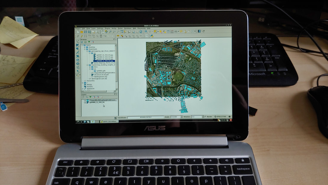
Recently I’ve been helping with the process of reworking our curriculum in response to the current restrictions. Among other things, am going to be running our new Year 1 GIS module designed around a blended learning approach. Even assuming that campuses are open in the autumn, we’re going to have restricted numbers of people in classrooms and many students will choose not to come to campus at all for safety and other reasons. This creates some challenges if, like us, you have somewhat old-fashioned GIS courses based in campus computer labs using site licenced ArcGIS. What can students do when working from home? Even if we were able to give out licence codes like sweets, it wouldn’t be practical to ask students to run ArcGIS on their own laptops. Some don’t have laptops at all. Meanwhile, although many of our students at Birmingham do own laptops, an unscientific survey of logos visible during lectures suggests that about half use Apple Macs. It’s technically possible to install ArcGIS on a Mac if one is prepared to set it up to also run Windows. Mac users tend, however, to be exactly the sort of people who have no interest in messing about with virtual machines or dual booting – they’ve bought a Mac because it just kinda works. So we need a different solution. For those who own a laptop, QGIS is a free, open source alternative to ArcGIS and is fairly platform agnostic, running across Windows, MacOS and Linux. Although QGIS is quite well developed, I’m not a huge fan of open source generally – I think it tends to cater to those who are passionate about computers rather than the majority of people who aren’t really that interested. Whenever I teach computing-related things, I always try to remember the students who struggle with even the basic principles – far too often you see a small but significant minority who get stuck with something as simple as moving or unzipping a file. There is no getting away from the fact that I’m a massive nerd, but I do like to try out doing things the hard way in order to figure out what’s the easiest way to do it. As an example, some of our students buy Chromebooks – and why not, they’re cheap, simple and reliable. Can you install QGIS on one? Yes… but. You have to install Linux in a custom shell and then install QGIS within that: As a result, even my ancient Chromebook with an underpowered ARM processor, can run a full desktop GIS so long as you’re willing to mess about with developer mode and the command line. Doing this sort of thing is my idea of fun. But there’s no way I’d suggest anyone but the most nerdy should attempt this and it’s certainly not something I’d ask my students to do.
The upshot is that I’ve been developing some new GIS teaching working on the principle that some of our students will be using ArcGIS as normal and some will be using QGIS on their own machines and some won’t have access to a computer at all. At Birmingham our lives are made a bit easier by having a relatively wealthy cohort of students, most of whom have their own PC. But it’s important to consider those students working remotely with nothing more than a mobile phone (likely with limited data), so I’ve been thinking about how we can make using GIS more of a team exercise with students working in their tutorial groups. Thus, I’m designing elements for the module that need nothing more than a smartphone. This can be as basic as using Google Maps, or undertaking basic data collection using a simple app like Ramblr. There are even opportunities to do more complex data collection creating your own attribute tables using something like SW Maps on Android. The students will work their way through different GIS exercises using different tools – accepting that not all will be able to access everything. They’ll then collaborate in tutorial groups to design a map-based project that they can work on together – assuming a range of skills and access to technology. This might mean that one person crunches data in QGIS while another does some field data collection and someone else hunts out interesting secondary data sources. It’s not perfect, but it scales out quite nicely to a point in the future where, hopefully, they all have equal access to campus computing resources and software again. Oh and why am I going to teach both QGIS and ArcGIS when it would be simpler just to move everything to QGIS as the open source evangelicals would demand? The short answer is because it would be totally unfair to ask our IT team to undertake the major task of installing QGIS on machines across campus at a moment when they’re struggling just to keep the basic infrastructure functioning for remote working. Maybe next year…
0 Comments
Leave a Reply. |
AuthorPhil Jones is a cultural geographer based at the University of Birmingham. Archives
September 2023
Categories |
Phil Jones, Geographer
The INTERMITTENTLY updated blog
Proudly powered by Weebly


 RSS Feed